
Pétange topographic map
Interactive map
Click on the map to display elevation.
About this map
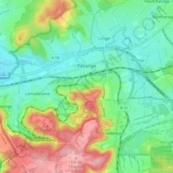
Name: Pétange topographic map, elevation, terrain.
Location: Pétange, Canton Esch-sur-Alzette, Luxembourg (49.52923 5.80813 49.57172 5.88743)
Average elevation: 317 m
Minimum elevation: 263 m
Maximum elevation: 422 m