
Soto topographic map
Interactive map
Click on the map to display elevation.
About this map
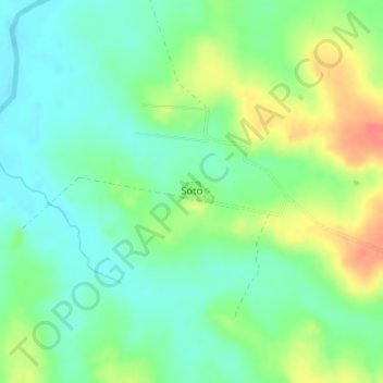
Name: Soto topographic map, elevation, terrain.
Location: Soto, Paysandú, 60000, Uruguay (-31.97600 -57.55602 -31.97453 -57.55316)
Average elevation: 84 m
Minimum elevation: 62 m
Maximum elevation: 122 m
Other topographic maps
Click on a map to view its topography, its elevation and its terrain.
Nuevo Paysandú
Uruguay > Paysandú > Nuevo Paysandú
Nuevo Paysandú, Paysandú, 60000, Uruguay
Average elevation: 14 m
Federación
Uruguay > Paysandú > Federación > Federación
Federación, Paysandú, 60000, Uruguay
Average elevation: 85 m