
Chaklala Cantonment topographic map
Interactive map
Click on the map to display elevation.
About this map
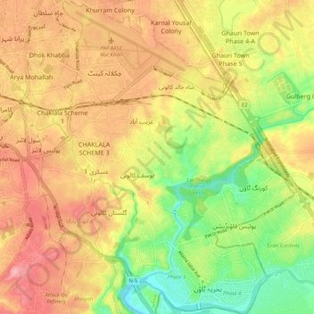
Name: Chaklala Cantonment topographic map, elevation, terrain.
Location: Chaklala Cantonment, Punjab, Pakistan (33.54315 73.06998 33.62763 73.15180)
Average elevation: 486 m
Minimum elevation: 418 m
Maximum elevation: 543 m
Other topographic maps
Click on a map to view its topography, its elevation and its terrain.
Bahria Town
Pakistan > Chaklala Cantonment > Bahria Town
Bahria Town, Rawalpindi District, Chaklala Cantonment, Punjab, 45730, Pakistan
Average elevation: 468 m