
Hastsal Village topographic map
Interactive map
Click on the map to display elevation.
About this map
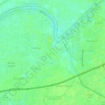
Name: Hastsal Village topographic map, elevation, terrain.
Average elevation: 215 m
Minimum elevation: 208 m
Maximum elevation: 220 m
Other topographic maps
Click on a map to view its topography, its elevation and its terrain.
Sector 5
India > Delhi > Patel Nagar Tehsil > Dwarka
Sector 5, Dwarka, Patel Nagar Tehsil, West Delhi, Delhi, India
Average elevation: 215 m
Raghubir Nagar
India > Delhi > Patel Nagar Tehsil
Raghubir Nagar, Patel Nagar Tehsil, West Delhi, Delhi, India
Average elevation: 217 m
Shiv Vihar
India > Delhi > Patel Nagar Tehsil
Shiv Vihar, Patel Nagar Tehsil, West Delhi, Delhi, India
Average elevation: 215 m
Janakpuri
India > Delhi > Patel Nagar Tehsil
Janakpuri, Patel Nagar Tehsil, West Delhi, Delhi, 110058, India
Average elevation: 217 m