
Bullet Tree Falls Village topographic map
Interactive map
Click on the map to display elevation.
About this map
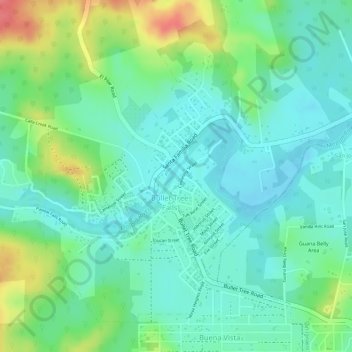
Name: Bullet Tree Falls Village topographic map, elevation, terrain.
Location: Bullet Tree Falls Village, Cayo, Belize (17.16176 -89.12506 17.18090 -89.10686)
Average elevation: 74 m
Minimum elevation: 49 m
Maximum elevation: 126 m
Other topographic maps
Click on a map to view its topography, its elevation and its terrain.
Belize River
Belize River, Cayo District, Cayo, POB159 BELMOPAN, Belize
Average elevation: 72 m
San Ignacio
Belize > Cayo > San Ignacio
San Ignacio, San Ignacio Town, Cayo, 000000, Belize
Average elevation: 99 m
Mountain Pine Ridge Forest Reserve
Belize > Cayo > Cayo District
Mountain Pine Ridge Forest Reserve, Cayo District, Cayo, Belize
Average elevation: 541 m
Bullet Tree Falls
Belize > Cayo > Bullet Tree Falls
Bullet Tree Falls, Cayo, 000000, Belize
Average elevation: 82 m