
Broads Park topographic map
Interactive map
Click on the map to display elevation.
About this map
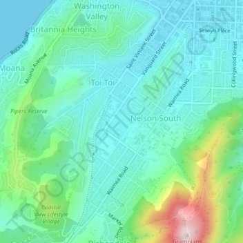
Name: Broads Park topographic map, elevation, terrain.
Location: Broads Park, Nelson South, Nelson, New Zealand (-41.28660 173.26836 -41.28418 173.27169)
Average elevation: 85 m
Minimum elevation: 0 m
Maximum elevation: 376 m
Other topographic maps
Click on a map to view its topography, its elevation and its terrain.
Haulashore Island
New Zealand > Nelson > Nelson
Haulashore Island, Britannia Heights, Nelson, New Zealand
Average elevation: 13 m