
Benicia topographic map
Interactive map
Click on the map to display elevation.
About this map
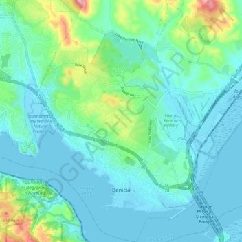
Name: Benicia topographic map, elevation, terrain.
Location: Benicia, Solano County, California, 94510, United States (38.03238 -122.20044 38.11112 -122.10377)
Average elevation: 53 m
Minimum elevation: -5 m
Maximum elevation: 289 m
Other topographic maps
Click on a map to view its topography, its elevation and its terrain.