
Shiremoor topographic map
Interactive map
Click on the map to display elevation.
About this map
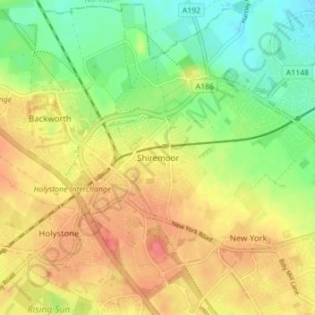
Name: Shiremoor topographic map, elevation, terrain.
Average elevation: 56 m
Minimum elevation: 28 m
Maximum elevation: 81 m
England trails, hiking, mountain biking, running and outdoor activities
Other topographic maps
Click on a map to view its topography, its elevation and its terrain.
Northumberland Square
United Kingdom > England > North Tyneside > North Shields
Average elevation: 29 m