
Heathfield topographic map
Interactive map
Click on the map to display elevation.
About this map
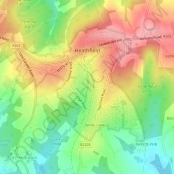
Name: Heathfield topographic map, elevation, terrain.
Average elevation: 128 m
Minimum elevation: 72 m
Maximum elevation: 184 m
Other topographic maps
Click on a map to view its topography, its elevation and its terrain.
Sandy Cross
United Kingdom > England > Wealden > Heathfield > Sandy Cross
Sandy Cross, Heathfield and Waldron, Heathfield, Wealden, East Sussex, South East England, England, TN21 8BS, United Kingdom
Average elevation: 112 m