
Dunmurry topographic map
Click on the map to display elevation.
About this map
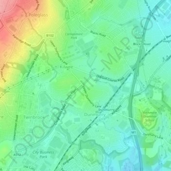
Name: Dunmurry topographic map, elevation, terrain.
Location: Dunmurry, Northern Ireland, United Kingdom (54.54533 -6.02001 54.56697 -5.99580)
Average elevation: 44 m
Minimum elevation: 12 m
Maximum elevation: 116 m
Northern Ireland trails, hiking, mountain biking, running and outdoor activities
Other topographic maps
Click on a map to view its topography, its elevation and its terrain.
Newcastle
United Kingdom > Northern Ireland
In 1910 Harry Ferguson flew a small plane across Newcastle beach in one of the first engine powered flights by aircraft in Ireland. He completed the flight in an attempt to win a £100 prize offered by the town for the first powered flight along the strand. His first take off ended badly, but according to a…
Average elevation: 115 m
Ballymoney
United Kingdom > Northern Ireland > County Antrim
In 1837, Lewis's Topographical Dictionary of Ireland, describes Ballymoney as "a market-town and post-town" containing 2,222 inhabitants (11,579 in the broader civil parish) with a long established linen market chiefly supplying the London market, and with "a very extensive trade ... in grain, butter, pork,…
Average elevation: 51 m
Derry/Londonderry
United Kingdom > Northern Ireland > County Londonderry
Derry is characterised by its distinctively hilly topography. The River Foyle forms a deep valley as it flows through the city, making Derry a place of very steep streets and sudden, startling views. The original walled city of Londonderry lies on a hill on the west bank of the River Foyle. In the past, the…
Average elevation: 88 m
Hen Mountain
United Kingdom > Northern Ireland > Newry, Mourne and Down District Council
Average elevation: 230 m
Castlecaufield
United Kingdom > Northern Ireland > County Tyrone > Castlecaulfield
Average elevation: 95 m
Loughgiel Millennium Centre
United Kingdom > Northern Ireland > County Antrim > Loughguile
Average elevation: 155 m
Ederney
United Kingdom > Northern Ireland > County Fermanagh
By 1797, the settlement is recorded in the Topographia Hibernica as Ederny Bridge and "fair days" were held there.
Average elevation: 91 m