
Starkville topographic map
Interactive map
Click on the map to display elevation.
About this map
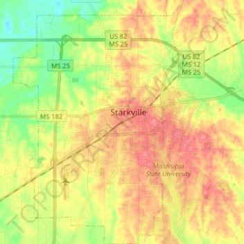
Name: Starkville topographic map, elevation, terrain.
Average elevation: 93 m
Minimum elevation: 58 m
Maximum elevation: 124 m
Other topographic maps
Click on a map to view its topography, its elevation and its terrain.
The Cotton District
United States > Mississippi > Oktibbeha County > Starkville
Average elevation: 106 m