
Make a donation
Gear up for your next adventure:
As an Amazon Associate, this site earns from qualifying purchases at no extra cost to you.
Harrison Township topographic map
Click on the map to display elevation.
Make a donation
Gear up for your next adventure:
As an Amazon Associate, this site earns from qualifying purchases at no extra cost to you.
About this map
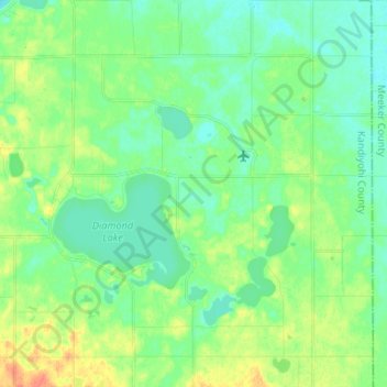
Name: Harrison Township topographic map, elevation, terrain.
Average elevation: 363 m
Minimum elevation: 350 m
Maximum elevation: 389 m
Make a donation
Gear up for your next adventure:
As an Amazon Associate, this site earns from qualifying purchases at no extra cost to you.
Other topographic maps
Click on a map to view its topography, its elevation and its terrain.
Minneapolis
United States > Minnesota > Hennepin County
Minneapolis is characterized by a diverse and dynamic topography. The city sits at an average elevation of approximately 830 feet (253 meters) above sea level, but this varies significantly across its landscape. The terrain is predominantly flat, interspersed with rolling hills, and is marked by the presence…
Average elevation: 270 m
Duluth
United States > Minnesota > Saint Louis County
Duluth's topography is distinctive, defined by its hilly terrain and its proximity to Lake Superior. The city is perched on an incline rising sharply from the lake, with elevations ranging from lake level at about 600 feet to approximately 1,400 feet at the ridge tops. This steep gradient creates dramatic…
Average elevation: 286 m
Rochester
United States > Minnesota > Olmsted County
With a slightly higher altitude and without the UHI as the Twin Cities, the climate is warm-summer humid continental climate (Köppen: Dfb) even being further south, with warm summers and cold winters. The city features four distinct seasons. Rochester sees on average 33.02 inches (839 mm) of rainfall and 51.9…
Average elevation: 354 m
Saint Paul
United States > Minnesota > Ramsey County
The year 1858 saw more than 1,000 steamboats service Saint Paul, making it a gateway for settlers to the Minnesota frontier or Dakota Territory. Geography was a primary reason the city became a transportation hub. The location was the last good point to land riverboats coming upriver due to the river valley's…
Average elevation: 268 m
Make a donation
Gear up for your next adventure:
As an Amazon Associate, this site earns from qualifying purchases at no extra cost to you.
Crow Wing County
Crow Wing County features a diverse and dynamic topography characterized primarily by its rolling hills, numerous lakes, and the scenic landscapes shaped by glacial activity. The region is part of the Central Lowlands physiographic province, which predominantly consists of gently undulating terrain that slopes…
Average elevation: 386 m
Make a donation
Gear up for your next adventure:
As an Amazon Associate, this site earns from qualifying purchases at no extra cost to you.
Saint Paul
United States > Minnesota > Ramsey County
The year 1858 saw more than 1,000 steamboats service Saint Paul, making it a gateway for settlers to the Minnesota frontier or Dakota Territory. Geography was a primary reason the city became a transportation hub. The location was the last good point to land riverboats coming upriver due to the river valley's…
Average elevation: 268 m
Make a donation
Gear up for your next adventure:
As an Amazon Associate, this site earns from qualifying purchases at no extra cost to you.
Make a donation
Gear up for your next adventure:
As an Amazon Associate, this site earns from qualifying purchases at no extra cost to you.
Make a donation
Gear up for your next adventure:
As an Amazon Associate, this site earns from qualifying purchases at no extra cost to you.
Make a donation
Gear up for your next adventure:
As an Amazon Associate, this site earns from qualifying purchases at no extra cost to you.
Make a donation
Gear up for your next adventure:
As an Amazon Associate, this site earns from qualifying purchases at no extra cost to you.
Make a donation
Gear up for your next adventure:
As an Amazon Associate, this site earns from qualifying purchases at no extra cost to you.
Make a donation
Gear up for your next adventure:
As an Amazon Associate, this site earns from qualifying purchases at no extra cost to you.
Pigeon River
United States > Minnesota > Cook County
The Pigeon River originates from a chain of lakes along the US-Canada border, the highest of which, and furthest west, is Mountain Lake. Among the Pigeon's tributaries is the Arrow River of Ontario, which rises in South Lake, west of and at a lower elevation than Mountain Lake. South Lake is separated only by…
Average elevation: 390 m
Make a donation
Gear up for your next adventure:
As an Amazon Associate, this site earns from qualifying purchases at no extra cost to you.
Make a donation
Gear up for your next adventure:
As an Amazon Associate, this site earns from qualifying purchases at no extra cost to you.
Make a donation
Gear up for your next adventure:
As an Amazon Associate, this site earns from qualifying purchases at no extra cost to you.
Make a donation
Gear up for your next adventure:
As an Amazon Associate, this site earns from qualifying purchases at no extra cost to you.
Make a donation
Gear up for your next adventure:
As an Amazon Associate, this site earns from qualifying purchases at no extra cost to you.
Make a donation
Gear up for your next adventure:
As an Amazon Associate, this site earns from qualifying purchases at no extra cost to you.
Make a donation
Gear up for your next adventure:
As an Amazon Associate, this site earns from qualifying purchases at no extra cost to you.
Duluth
United States > Minnesota > Saint Louis County
Duluth's topography is dominated by a steep hillside that climbs from Lake Superior to high inland elevations. Duluth has been called "the San Francisco of the Midwest", alluding to San Francisco's similar water-to-hilltop topography. This similarity was most evident before World War II, when Duluth had a…
Average elevation: 276 m
Make a donation
Gear up for your next adventure:
As an Amazon Associate, this site earns from qualifying purchases at no extra cost to you.
Make a donation
Gear up for your next adventure:
As an Amazon Associate, this site earns from qualifying purchases at no extra cost to you.
Red Wing
United States > Minnesota > Goodhue County
According to the United States Census Bureau, the city has an area of 41.19 square miles (106.68 km2), of which 34.60 square miles (89.61 km2) is land and 6.59 square miles (17.07 km2) is water. The city is at the northern edge of the Driftless Area of karst topography.
Average elevation: 263 m
Make a donation
Gear up for your next adventure:
As an Amazon Associate, this site earns from qualifying purchases at no extra cost to you.
Make a donation
Gear up for your next adventure:
As an Amazon Associate, this site earns from qualifying purchases at no extra cost to you.
Brule Lake
United States > Minnesota > Cook County > West Cook
Brule Lake lies in a region which has seen human population since the end of the last ice age. It has variously been within the territory of the Dakota, Cree, Ojibwa, French, British, and Americans. It saw little development until the opening of a railroad that allowed loggers easier access to the interior of…
Average elevation: 579 m
Make a donation
Gear up for your next adventure:
As an Amazon Associate, this site earns from qualifying purchases at no extra cost to you.
Duluth
United States > Minnesota > Saint Louis County
Duluth's topography is dominated by a steep hillside that climbs from Lake Superior to high inland elevations. Duluth has been called "the San Francisco of the Midwest," alluding to San Francisco's similar water-to-hilltop topography. This similarity was most evident before World War II, when Duluth had a…
Average elevation: 286 m
Make a donation
Gear up for your next adventure:
As an Amazon Associate, this site earns from qualifying purchases at no extra cost to you.
Make a donation
Gear up for your next adventure:
As an Amazon Associate, this site earns from qualifying purchases at no extra cost to you.
Rochester
United States > Minnesota > Olmsted County
With a slightly higher altitude and without the same Urban heat island effect as the Twin Cities, the climate is warm-summer humid continental climate (Köppen: Dfb), which is cooler than the Twin Cities, despite being further south, with warm summers and cold winters. The city features four distinct seasons.…
Average elevation: 354 m
Make a donation
Gear up for your next adventure:
As an Amazon Associate, this site earns from qualifying purchases at no extra cost to you.
Proctor
United States > Minnesota > Saint Louis County
Proctor is adjacent to Duluth's Bayview Heights neighborhood, with which it forms something of a contiguous community unit due to Bayview Heights' topographical separation (the hill) from adjacent West Duluth. It is bounded by the city of Hermantown to the north, Midway Township to the west, Bayview Heights to…
Average elevation: 374 m
Make a donation
Gear up for your next adventure:
As an Amazon Associate, this site earns from qualifying purchases at no extra cost to you.