Geolocate

Harrison Township topographic map

Interactive map

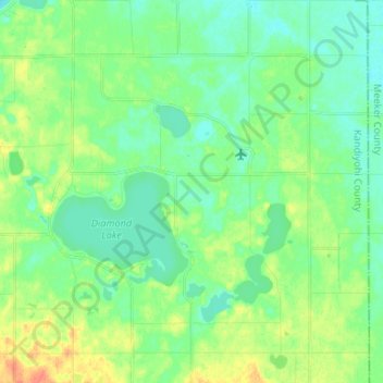
Click on the map to display elevation.

About this map

Name: Harrison Township topographic map, elevation, terrain.

Location: Harrison Township, Kandiyohi County, Minnesota, United States (45.14596 -94.87940 45.23903 -94.75702)

Average elevation: 363 m

Minimum elevation: 350 m

Maximum elevation: 389 m

Other topographic maps

Click on a map to view its topography, its elevation and its terrain.

Minneapolis

United States > Minnesota > Hennepin County

Minneapolis is characterized by a diverse and dynamic topography. The city sits at an average elevation of approximately 830 feet (253 meters) above sea level, but this varies significantly across its landscape. The terrain is predominantly flat, interspersed with rolling hills, and is marked by the presence…

Average elevation: 270 m

Duluth

United States > Minnesota > Saint Louis County

Duluth's topography is dominated by a steep hillside that climbs from Lake Superior to high inland elevations. Duluth has been called "the San Francisco of the Midwest," alluding to San Francisco's similar water-to-hilltop topography. This similarity was most evident before World War II, when Duluth had a…

Average elevation: 286 m

Duluth

United States > Minnesota > Saint Louis County

Duluth's topography is distinctive, defined by its hilly terrain and its proximity to Lake Superior. The city is perched on an incline rising sharply from the lake, with elevations ranging from lake level at about 600 feet to approximately 1,400 feet at the ridge tops. This steep gradient creates dramatic…

Average elevation: 286 m

Saint Paul

United States > Minnesota > Ramsey County

The year 1858 saw more than 1,000 steamboats service Saint Paul, making it a gateway for settlers to the Minnesota frontier or Dakota Territory. Geography was a primary reason the city became a transportation hub. The location was the last good point to land riverboats coming upriver due to the river valley's…

Average elevation: 268 m

Bloomington

United States > Minnesota > Hennepin County

Average elevation: 255 m

Eagan

United States > Minnesota > Dakota County

Average elevation: 267 m

Edina

United States > Minnesota > Hennepin County

Average elevation: 271 m

Rochester

United States > Minnesota > Olmsted County

With a slightly higher altitude and without the UHI as the Twin Cities, the climate is warm-summer humid continental climate (Köppen: Dfb) even being further south, with warm summers and cold winters. The city features four distinct seasons. Rochester sees on average 33.02 inches (839 mm) of rainfall and 51.9…

Average elevation: 354 m

Crow Wing County

United States > Minnesota

Crow Wing County features a diverse and dynamic topography characterized primarily by its rolling hills, numerous lakes, and the scenic landscapes shaped by glacial activity. The region is part of the Central Lowlands physiographic province, which predominantly consists of gently undulating terrain that slopes…

Average elevation: 386 m

Mankato

United States > Minnesota > Blue Earth County

Average elevation: 285 m

Ramsey County

United States > Minnesota

Average elevation: 279 m

Pontoria

United States > Minnesota > Cass County

Average elevation: 409 m

Dakota County

United States > Minnesota

Average elevation: 278 m

Aitkin County

United States > Minnesota

Average elevation: 385 m

Maple Grove

United States > Minnesota > Hennepin County

Average elevation: 278 m

Lino Lakes

United States > Minnesota > Anoka County

Average elevation: 274 m

Oslo

United States > Minnesota > Marshall County

Average elevation: 246 m

Eden Prairie

United States > Minnesota > Hennepin County

In 1853, John H. McKenzie and Minnesota Territory secretary Alexander Wilkins platted the town of Hennepin along the Minnesota River in what is now southeastern Eden Prairie. According to area historian Helen Holden Anderson, topographic disadvantages for the transport of agricultural goods caused Hennepin to…

Average elevation: 259 m

Dellwood

United States > Minnesota > Washington County

Average elevation: 289 m

Frazee

United States > Minnesota > Becker County

Average elevation: 424 m

Watertown

United States > Minnesota > Carver County

Average elevation: 291 m

Cromwell

United States > Minnesota > Carlton County

Average elevation: 400 m

Sandstone

United States > Minnesota > Pine County

Average elevation: 332 m

Comstock

United States > Minnesota > Clay County

Average elevation: 281 m

Chaska

United States > Minnesota > Carver County

Average elevation: 273 m

Annandale

United States > Minnesota > Wright County

Average elevation: 324 m

Olmsted County

United States > Minnesota

Average elevation: 354 m

London

United States > Minnesota > Lake County

Average elevation: 406 m

Kensington

United States > Minnesota > Douglas County

Average elevation: 398 m

Twin Lakes

United States > Minnesota > Goodhue County > Red Wing

Average elevation: 240 m

Hallock

United States > Minnesota > Kittson County

Average elevation: 249 m

Winton

United States > Minnesota > Saint Louis County

Average elevation: 414 m

Harmony

United States > Minnesota > Fillmore County

Average elevation: 404 m

Athens

United States > Minnesota > Isanti County

Average elevation: 284 m

Benson

United States > Minnesota > Swift County

Average elevation: 319 m

Minneapolis

United States > Minnesota > Hennepin County

A 1959 report by the US Soil Conservation Service listed Minneapolis's elevation above mean sea level as 830 feet (250 meters). The city's lowest elevation of 687 feet (209 m) above sea level is near the confluence of Minnehaha Creek with the Mississippi River. Sources disagree on the exact location and…

Average elevation: 270 m

Lake Elmo

United States > Minnesota > Washington County

Average elevation: 287 m

Lake Township

United States > Minnesota > Wabasha County

Average elevation: 287 m

Buffalo Lake

United States > Minnesota > Renville County

Average elevation: 325 m

Embarrass

United States > Minnesota > Saint Louis County

Average elevation: 438 m

Minnetonka

United States > Minnesota > Hennepin County

Average elevation: 290 m

Cotton

United States > Minnesota > Saint Louis County

Average elevation: 405 m

Minneapolis

United States > Minnesota > Hennepin County

A 1959 report by the US Soil Conservation Service listed Minneapolis's elevation above mean sea level as 830 feet (250 meters). The city's lowest elevation of 687 feet (209 m) above sea level is near the confluence of Minnehaha Creek with the Mississippi River. Sources disagree on the exact location and…

Average elevation: 270 m

Bemidji

United States > Minnesota > Beltrami County

Average elevation: 417 m

Frontenac

United States > Minnesota > Goodhue County

Average elevation: 243 m

Houston County

United States > Minnesota

Average elevation: 296 m

Orr

United States > Minnesota > Saint Louis County

Average elevation: 404 m

Cromwell

United States > Minnesota > Carlton County

Average elevation: 400 m

Rochester

United States > Minnesota > Olmsted County

With a slightly higher altitude and without the same Urban heat island effect as the Twin Cities, the climate is warm-summer humid continental climate (Köppen: Dfb), which is cooler than the Twin Cities, despite being further south, with warm summers and cold winters. The city features four distinct seasons.…

Average elevation: 354 m

Lakefield

United States > Minnesota > Jackson County

Average elevation: 450 m

Olivia

United States > Minnesota > Renville County

Average elevation: 330 m

Midvale

United States > Minnesota > Ramsey County > Maplewood

Average elevation: 305 m

Baxter

United States > Minnesota > Crow Wing County

Average elevation: 366 m

Bertha

United States > Minnesota > Todd County

Average elevation: 427 m

Johnsville

United States > Minnesota > Anoka County > Blaine

Average elevation: 275 m

Long Prairie

United States > Minnesota > Todd County

Average elevation: 408 m

Misquah Hills

United States > Minnesota > Cook County

Average elevation: 629 m

Staples

United States > Minnesota > Todd County

Average elevation: 387 m

Stillwater

United States > Minnesota > Washington County

Average elevation: 259 m

Kanabec County

United States > Minnesota

Average elevation: 332 m

Saint Cloud

United States > Minnesota > Stearns County

Average elevation: 319 m

Maplewood

United States > Minnesota > Ramsey County

Average elevation: 279 m

Rosemount

United States > Minnesota > Dakota County

Average elevation: 287 m

New Prague

United States > Minnesota > Le Sueur County

Average elevation: 302 m

Fairmont

United States > Minnesota > Martin County

Average elevation: 361 m

Washington County

United States > Minnesota

Average elevation: 283 m

Maplewood

United States > Minnesota > Ramsey County

Average elevation: 279 m

Fridley

United States > Minnesota > Anoka County

Average elevation: 270 m

Wright County

United States > Minnesota

Average elevation: 307 m

Erin Township

United States > Minnesota > Rice County

Average elevation: 334 m

Detroit Lakes

United States > Minnesota > Becker County

Average elevation: 416 m

Warba

United States > Minnesota > Itasca County

Average elevation: 392 m

Ruthton

United States > Minnesota > Pipestone County

Average elevation: 527 m

Garrison

United States > Minnesota > Crow Wing County

Average elevation: 383 m

Blaine

United States > Minnesota > Anoka County

Average elevation: 274 m

Cass Lake

United States > Minnesota > Cass County

Average elevation: 402 m

Northfield

United States > Minnesota > Rice County

According to the United States Census Bureau, the city has an area of 8.61 square miles (22.30 km2); 8.56 square miles (22.17 km2) is land and 0.05 square miles (0.13 km2) is water. The peak elevation is about 912 ft (278 m).

Average elevation: 298 m

Arden Hills

United States > Minnesota > Ramsey County

Average elevation: 280 m

Janesville

United States > Minnesota > Waseca County

Average elevation: 320 m

Madison

United States > Minnesota > Lac qui Parle County

Average elevation: 332 m

West Cook

United States > Minnesota > Cook County

Average elevation: 501 m

Emily

United States > Minnesota > Crow Wing County

Average elevation: 393 m

Mahnomen County

United States > Minnesota

Average elevation: 411 m

Makinen

United States > Minnesota > Saint Louis County

Average elevation: 420 m

Plymouth

United States > Minnesota > Hennepin County

Average elevation: 294 m

New Hope

United States > Minnesota > Hennepin County

Average elevation: 278 m