
Hemlo topographic map
Interactive map
Click on the map to display elevation.
About this map
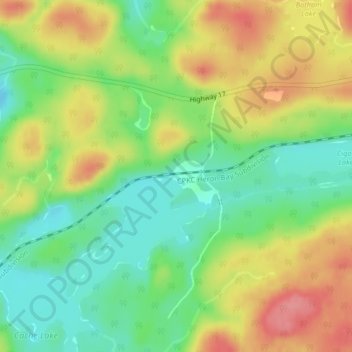
Name: Hemlo topographic map, elevation, terrain.
Average elevation: 320 m
Minimum elevation: 281 m
Maximum elevation: 368 m
Other topographic maps
Click on a map to view its topography, its elevation and its terrain.
Lake Nipigon
Canada > Ontario > Unorganized Thunder Bay District
Lake Nipigon, Unorganized Thunder Bay District, Thunder Bay District, Northwestern Ontario, Ontario, Canada
Average elevation: 307 m
Sperm Creek
Canada > Ontario > Unorganized Thunder Bay District
Sperm Creek, Unorganized Thunder Bay District, Thunder Bay District, Northwestern Ontario, Ontario, Canada
Average elevation: 386 m
Trunk Island
Canada > Ontario > Unorganized Thunder Bay District
Trunk Island, Unorganized Thunder Bay District, Thunder Bay District, Northwestern Ontario, Ontario, Canada
Average elevation: 258 m