Geolocate

Ona topographic map

Interactive map

Click on the map to display elevation.

About this map

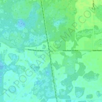
Name: Ona topographic map, elevation, terrain.

Location: Ona, Hardee County, Florida, United States (27.46198 -81.93897 27.50198 -81.89897)

Average elevation: 27 m

Minimum elevation: 22 m

Maximum elevation: 34 m

Other topographic maps

Click on a map to view its topography, its elevation and its terrain.

Bowling Green

United States > Florida > Hardee County

Average elevation: 31 m

Wauchula

United States > Florida > Hardee County

Average elevation: 30 m

Peace River

United States > Florida > Hardee County

Average elevation: 25 m

Zolfo Springs

United States > Florida > Hardee County

Average elevation: 20 m

Peace River

United States > Florida > Hardee County

Average elevation: 25 m