
Gemeinde Haiming topographic map
Interactive map
Click on the map to display elevation.
About this map
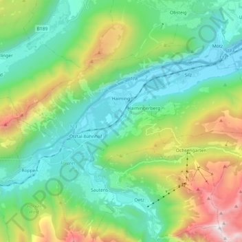
Name: Gemeinde Haiming topographic map, elevation, terrain.
Location: Gemeinde Haiming, Bezirk Imst, Tyrol, Austria (47.20969 10.80527 47.27712 10.98630)
Average elevation: 1,235 m
Minimum elevation: 641 m
Maximum elevation: 2,748 m