
Noir Island topographic map
Interactive map
Click on the map to display elevation.
About this map
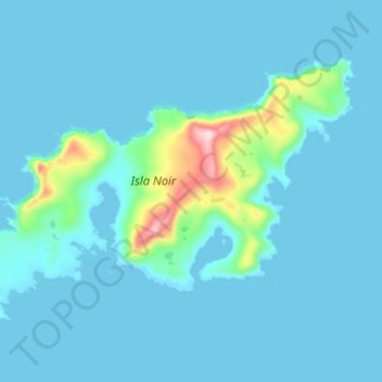
Name: Noir Island topographic map, elevation, terrain.
Average elevation: 31 m
Minimum elevation: -2 m
Maximum elevation: 360 m
Other topographic maps
Click on a map to view its topography, its elevation and its terrain.
Grandes Ventisqueros
Chile > XII Region of Magallanes and Chilean Antarctica > Punta Arenas
Grandes Ventisqueros, Punta Arenas, Provincia de Magallanes, XII Region of Magallanes and Chilean Antarctica, Chile
Average elevation: 503 m