
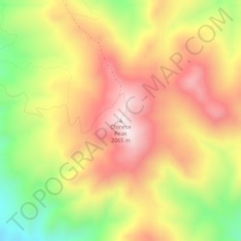
Chinese Peak topographic map
Interactive map
Click on the map to display elevation.
About this map
Name: Chinese Peak topographic map, elevation, terrain.
Average elevation: 1,830 m
Minimum elevation: 1,537 m
Maximum elevation: 2,067 m
Other topographic maps
Click on a map to view its topography, its elevation and its terrain.
Snake River
United States of America > Idaho
Snake River, Washington County, Idaho, 83672, United States of America
Average elevation: 644 m
Sawtooth National Forest
United States of America > Idaho > Rupert
Sawtooth National Forest, Sharon Court, Rupert, Minidoka County, Idaho, 83350, United States of America
Average elevation: 1,608 m
Genesee
United States of America > Idaho > Genesee
Genesee, Latah County, Idaho, 83832, United States of America
Average elevation: 824 m
Butte County
United States of America > Idaho
Butte County, Idaho, United States of America
Average elevation: 1,914 m
Camas County
United States of America > Idaho
Camas County, Idaho, United States of America
Average elevation: 2,002 m
Eagle Rock
United States of America > Idaho
Eagle Rock, Idaho County, Idaho, United States of America
Average elevation: 1,164 m
Teton
United States of America > Idaho > Teton
Teton, Fremont County, Idaho, 83451, United States of America
Average elevation: 1,509 m
Springston
United States of America > Idaho
Springston, Kootenai County, Idaho, 83833, United States of America
Average elevation: 721 m