
Ameenpur mandal topographic map
Interactive map
Click on the map to display elevation.
About this map
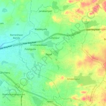
Name: Ameenpur mandal topographic map, elevation, terrain.
Location: Ameenpur mandal, Sangareddy, Telangana, India (17.50304 78.28001 17.58439 78.35002)
Average elevation: 552 m
Minimum elevation: 523 m
Maximum elevation: 603 m
Other topographic maps
Click on a map to view its topography, its elevation and its terrain.
Patelguda
India > Telangana > Ameenpur mandal
Patelguda, Ameenpur mandal, Sangareddy, Telangana, 502319, India
Average elevation: 538 m