
Haro topographic map
Interactive map
Click on the map to display elevation.
About this map
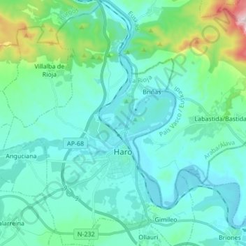
Name: Haro topographic map, elevation, terrain.
Location: Haro, Rioja, 26200, Spain (42.53873 -2.91290 42.63836 -2.81768)
Average elevation: 534 m
Minimum elevation: 429 m
Maximum elevation: 1,110 m
Other topographic maps
Click on a map to view its topography, its elevation and its terrain.