
Roseville topographic map
Interactive map
Click on the map to display elevation.
About this map
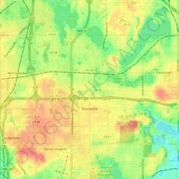
Name: Roseville topographic map, elevation, terrain.
Location: Roseville, Ramsey County, Minnesota, United States (44.99172 -93.20812 45.03590 -93.10588)
Average elevation: 284 m
Minimum elevation: 253 m
Maximum elevation: 311 m