
Arcadia topographic map
Interactive map
Click on the map to display elevation.
About this map
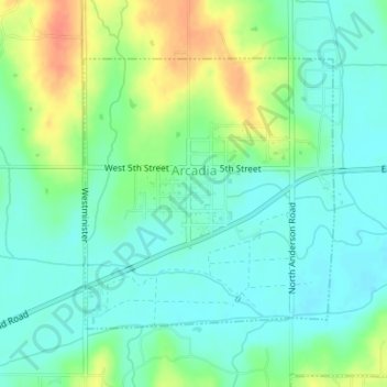
Name: Arcadia topographic map, elevation, terrain.
Location: Arcadia, Oklahoma County, Oklahoma, 73001, United States (35.65585 -97.33612 35.67471 -97.31461)
Average elevation: 302 m
Minimum elevation: 286 m
Maximum elevation: 334 m