
Thank you for supporting this site ❤️
Make a donation
Make a donation
Gear up for your next adventure:
As an Amazon Associate, this site earns from qualifying purchases at no extra cost to you.
Oostkamp topographic map
Click on the map to display elevation.
Thank you for supporting this site ❤️
Make a donation
Make a donation
Gear up for your next adventure:
As an Amazon Associate, this site earns from qualifying purchases at no extra cost to you.
About this map
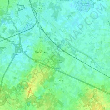
Name: Oostkamp topographic map, elevation, terrain.
Location: Oostkamp, Brugge, West Flanders, 8020, Belgium (51.11573 3.19152 51.18646 3.29736)
Average elevation: 8 m
Minimum elevation: 1 m
Maximum elevation: 22 m
Thank you for supporting this site ❤️
Make a donation
Make a donation
Gear up for your next adventure:
As an Amazon Associate, this site earns from qualifying purchases at no extra cost to you.