
Thank you for supporting this site ❤️
Make a donation
Make a donation
Gear up for your next adventure:
As an Amazon Associate, this site earns from qualifying purchases at no extra cost to you.
Oracle topographic map
Click on the map to display elevation.
Thank you for supporting this site ❤️
Make a donation
Make a donation
Gear up for your next adventure:
As an Amazon Associate, this site earns from qualifying purchases at no extra cost to you.
About this map
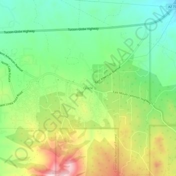
Name: Oracle topographic map, elevation, terrain.
Location: Oracle, Pinal County, Arizona, 85623, United States (32.58997 -110.78518 32.62997 -110.74518)
Average elevation: 1,380 m
Minimum elevation: 1,255 m
Maximum elevation: 1,578 m
Thank you for supporting this site ❤️
Make a donation
Make a donation
Gear up for your next adventure:
As an Amazon Associate, this site earns from qualifying purchases at no extra cost to you.