
Volksrust topographic map
Interactive map
Click on the map to display elevation.
About this map
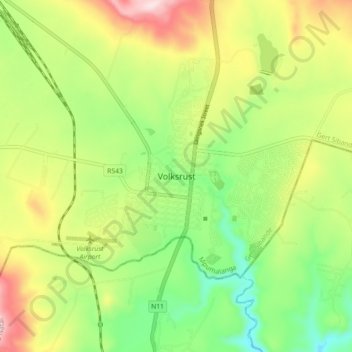
Name: Volksrust topographic map, elevation, terrain.
Average elevation: 1,688 m
Minimum elevation: 1,531 m
Maximum elevation: 1,909 m
Other topographic maps
Click on a map to view its topography, its elevation and its terrain.
Amersfoort
South Africa > Mpumalanga > Gert Sibande > Pixley Ka Seme Local Municipality
Amersfoort, Pixley Ka Seme Local Municipality, Gert Sibande, Mpumalanga, South Africa
Average elevation: 1,660 m