
Kirkjufell topographic map
Interactive map
Click on the map to display elevation.
About this map
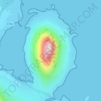
Name: Kirkjufell topographic map, elevation, terrain.
Average elevation: 34 m
Minimum elevation: -3 m
Maximum elevation: 459 m
Other topographic maps
Click on a map to view its topography, its elevation and its terrain.
Grundarfjörður
Iceland > Grundarfjarðarbær > Grundarfjörður
Grundarfjörður, Grundarfjarðarbær, 350, Iceland
Average elevation: 181 m