
Thank you for supporting this site ❤️
Make a donation
Make a donation
Gear up for your next adventure:
As an Amazon Associate, this site earns from qualifying purchases at no extra cost to you.
Umbraj topographic map
Click on the map to display elevation.
Thank you for supporting this site ❤️
Make a donation
Make a donation
Gear up for your next adventure:
As an Amazon Associate, this site earns from qualifying purchases at no extra cost to you.
About this map
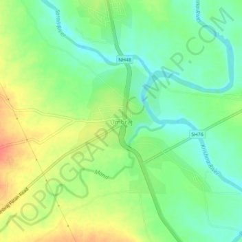
Name: Umbraj topographic map, elevation, terrain.
Location: Umbraj, Karad, Satara, Maharashtra, 415109, India (17.37800 74.07850 17.41800 74.11850)
Average elevation: 596 m
Minimum elevation: 571 m
Maximum elevation: 663 m
Thank you for supporting this site ❤️
Make a donation
Make a donation
Gear up for your next adventure:
As an Amazon Associate, this site earns from qualifying purchases at no extra cost to you.