
Bernards Township topographic map
Interactive map
Click on the map to display elevation.
About this map
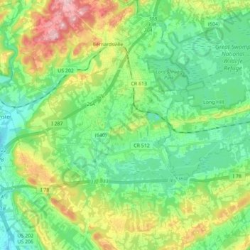
Name: Bernards Township topographic map, elevation, terrain.
Average elevation: 105 m
Minimum elevation: 34 m
Maximum elevation: 263 m
Other topographic maps
Click on a map to view its topography, its elevation and its terrain.
Liberty Corner
United States > New Jersey > Somerset County > Bernards Township > Liberty Corner
Average elevation: 85 m