
Fouday topographic map
Interactive map
Click on the map to display elevation.
Fouday
The village is served by the National Road (Route nationale) 420 which connects Strasbourg with Saint-Dié. The town is also traversed by the railway line - here just a single track - that connects these two urban centres. The mountain topography of the region keeps the road and railway running in close parallel along the Bruche Valley.
About this map
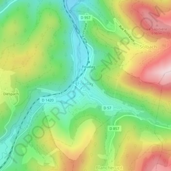
Name: Fouday topographic map, elevation, terrain.
Average elevation: 519 m
Minimum elevation: 373 m
Maximum elevation: 725 m