
Eagle Grove topographic map
Interactive map
Click on the map to display elevation.
About this map
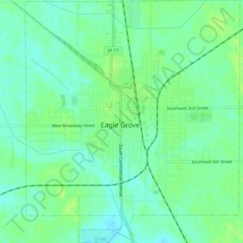
Name: Eagle Grove topographic map, elevation, terrain.
Location: Eagle Grove, Wright County, Iowa, United States (42.64822 -93.92207 42.68098 -93.88260)
Average elevation: 339 m
Minimum elevation: 332 m
Maximum elevation: 345 m