
Otis topographic map
Interactive map
Click on the map to display elevation.
About this map
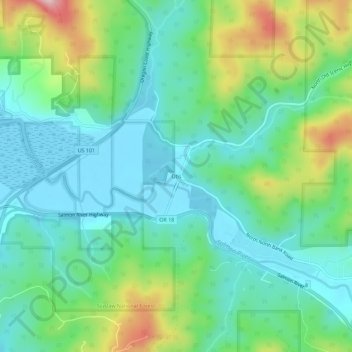
Name: Otis topographic map, elevation, terrain.
Location: Otis, Lincoln County, Oregon, 97368, United States (45.00427 -123.96650 45.04427 -123.92650)
Average elevation: 74 m
Minimum elevation: -2 m
Maximum elevation: 266 m
Other topographic maps
Click on a map to view its topography, its elevation and its terrain.
Seal Rock State Recreation Site
United States > Oregon > Lincoln County > Seal Rock
Average elevation: 16 m