
Udumbanchola topographic map
Interactive map
Click on the map to display elevation.
About this map
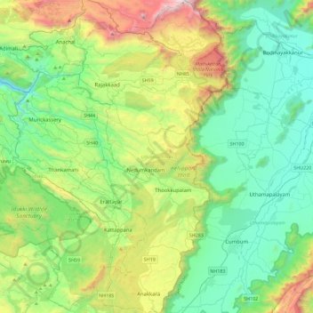
Name: Udumbanchola topographic map, elevation, terrain.
Location: Udumbanchola, Idukki, Kerala, India (9.63729 77.01326 10.08301 77.27231)
Average elevation: 833 m
Minimum elevation: 243 m
Maximum elevation: 2,438 m
Other topographic maps
Click on a map to view its topography, its elevation and its terrain.