
Chatorkhand topographic map
Interactive map
Click on the map to display elevation.
About this map
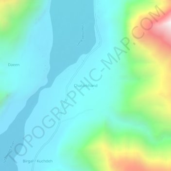
Name: Chatorkhand topographic map, elevation, terrain.
Location: Chatorkhand, Gilgit-Baltistan, Pakistan (36.32711 73.82666 36.36711 73.86666)
Average elevation: 2,332 m
Minimum elevation: 2,017 m
Maximum elevation: 3,517 m