
Sutton Abinger topographic map
Interactive map
Click on the map to display elevation.
About this map
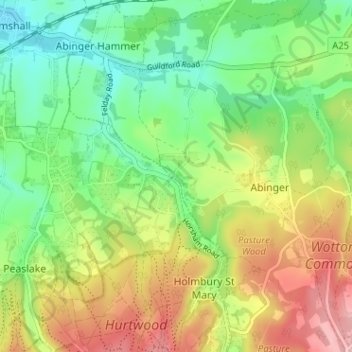
Name: Sutton Abinger topographic map, elevation, terrain.
Average elevation: 146 m
Minimum elevation: 79 m
Maximum elevation: 244 m
Other topographic maps
Click on a map to view its topography, its elevation and its terrain.
Abinger Bottom
United Kingdom > England > Surrey > Mole Valley > Abinger
Abinger Bottom, Abinger, Mole Valley, Surrey, England, RH5 6JN, United Kingdom
Average elevation: 196 m