
Hawbottom topographic map
Interactive map
Click on the map to display elevation.
About this map
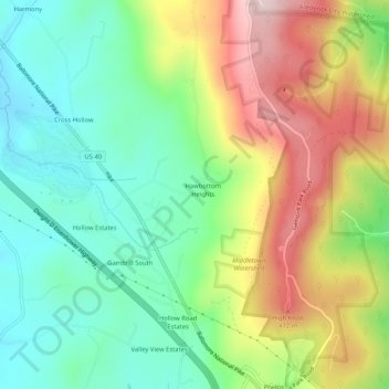
Name: Hawbottom topographic map, elevation, terrain.
Location: Hawbottom, Frederick County, Maryland, 21769, United States (39.45371 -77.52776 39.49371 -77.48776)
Average elevation: 309 m
Minimum elevation: 168 m
Maximum elevation: 534 m