
Kalasubai peak topographic map
Interactive map
Click on the map to display elevation.
Kalasubai peak
Kalsubai (Marathi: कळसूबाई शिखर) is a mountain in the Western Ghats, located in the Indian state of Maharashtra. Its summit, situated at an elevation of 1,646 metres (5,400 ft), is the highest point in Maharashtra.
About this map
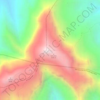
Name: Kalasubai peak topographic map, elevation, terrain.
Location: Kalasubai peak, Akola, Ahmednagar District, India (19.60026 73.71090 19.60036 73.71100)
Average elevation: 1,210 m
Minimum elevation: 784 m
Maximum elevation: 1,617 m