
Raz Island topographic map
Interactive map
Click on the map to display elevation.
About this map
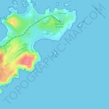
Name: Raz Island topographic map, elevation, terrain.
Location: Raz Island, Longis, St Anne, Alderney, Guernsey (49.71767 -2.16855 49.71922 -2.16655)
Average elevation: 7 m
Minimum elevation: -1 m
Maximum elevation: 69 m