
Fort Madison topographic map
Interactive map
Click on the map to display elevation.
About this map
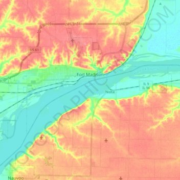
Name: Fort Madison topographic map, elevation, terrain.
Location: Fort Madison, Lee County, Iowa, 52627, United States (40.57045 -91.44105 40.66733 -91.25599)
Average elevation: 191 m
Minimum elevation: 156 m
Maximum elevation: 224 m
Other topographic maps
Click on a map to view its topography, its elevation and its terrain.
Shopton Park
United States > Iowa > Lee County > Fort Madison
Shopton Park, Fort Madison, Lee County, Iowa, United States
Average elevation: 166 m