
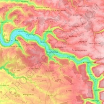
Künzelsau topographic map
Interactive map
Click on the map to display elevation.
About this map
Name: Künzelsau topographic map, elevation, terrain.
Average elevation: 360 m
Minimum elevation: 198 m
Maximum elevation: 446 m
The city of Künzelsau is located, at elevation 210–435 m (689–1,427 ft), along the Kocher River, a right tributary of the Neckar River, some 40 km east (25 mi) of Heilbronn. The city is, after Öhringen, the second largest city of the Hohenlohe district, whose seat it is.