
Kampung Padang Cina topographic map
Interactive map
Click on the map to display elevation.
About this map
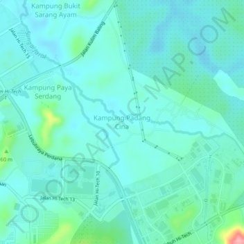
Name: Kampung Padang Cina topographic map, elevation, terrain.
Location: Kampung Padang Cina, Kulim, Kedah, 09600, Malaysia (5.41799 100.56166 5.45799 100.60166)
Average elevation: 31 m
Minimum elevation: 10 m
Maximum elevation: 138 m