
Chapelton topographic map
Interactive map
Click on the map to display elevation.
About this map
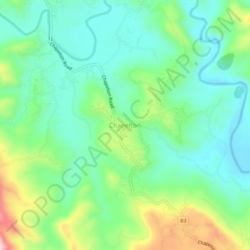
Name: Chapelton topographic map, elevation, terrain.
Location: Chapelton, Clarendon, Middlesex County, Jamaica (18.06438 -77.28639 18.10438 -77.24639)
Average elevation: 227 m
Minimum elevation: 149 m
Maximum elevation: 410 m
Other topographic maps
Click on a map to view its topography, its elevation and its terrain.
Rhymesbury
Jamaica > Clarendon > Rhymesbury
Rhymesbury, Clarendon, Middlesex County, Jamaica
Average elevation: 35 m