
雪ノ下2 topographic map
Interactive map
Click on the map to display elevation.
About this map
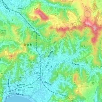
Name: 雪ノ下2 topographic map, elevation, terrain.
Location: 雪ノ下2, Kamakura, Kanagawa Prefecture, 248-8588, Japan (35.30696 139.53553 35.34696 139.57553)
Average elevation: 49 m
Minimum elevation: -4 m
Maximum elevation: 145 m