
La Louvière topographic map
Interactive map
Click on the map to display elevation.
About this map
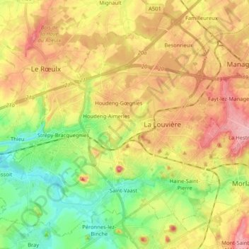
Name: La Louvière topographic map, elevation, terrain.
Location: La Louvière, Hainaut, Wallonia, 7100, Belgium (50.43330 4.06994 50.52495 4.22997)
Average elevation: 107 m
Minimum elevation: 43 m
Maximum elevation: 176 m
Other topographic maps
Click on a map to view its topography, its elevation and its terrain.
Houdeng-Gœgnies
Belgium > Hainaut > La Louvière > La Louvière > Houdeng-Gœgnies
Average elevation: 115 m