
Thank you for supporting this site ❤️
Make a donation
Make a donation
Gear up for your next adventure:
As an Amazon Associate, this site earns from qualifying purchases at no extra cost to you.
Pucalpa topographic map
Click on the map to display elevation.
Thank you for supporting this site ❤️
Make a donation
Make a donation
Gear up for your next adventure:
As an Amazon Associate, this site earns from qualifying purchases at no extra cost to you.
About this map
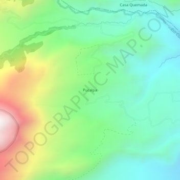
Name: Pucalpa topographic map, elevation, terrain.
Location: Pucalpa, Imantag, Cotacachi, Imbabura, Ecuador (0.36948 -78.31379 0.40948 -78.27379)
Average elevation: 2,925 m
Minimum elevation: 2,494 m
Maximum elevation: 3,844 m
Thank you for supporting this site ❤️
Make a donation
Make a donation
Gear up for your next adventure:
As an Amazon Associate, this site earns from qualifying purchases at no extra cost to you.