
Cessange topographic map
Interactive map
Click on the map to display elevation.
About this map
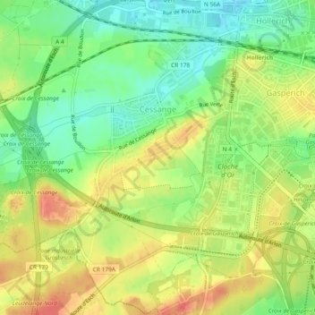
Name: Cessange topographic map, elevation, terrain.
Location: Cessange, Luxembourg, Canton Luxembourg, Luxembourg (49.57027 6.07305 49.60029 6.11649)
Average elevation: 291 m
Minimum elevation: 263 m
Maximum elevation: 319 m
Other topographic maps
Click on a map to view its topography, its elevation and its terrain.
Luxembourg City: Old Quarters & Fortifications
Luxembourg > Canton Luxembourg > Luxembourg
Average elevation: 294 m