Geolocate

Heiligenhafen topographic map

Click on the map to display elevation.

About this map

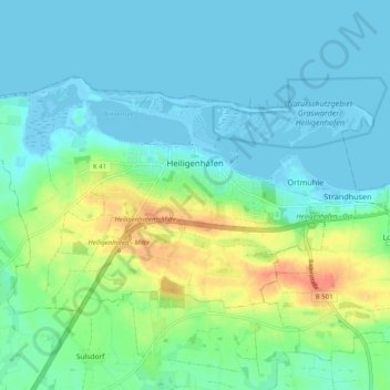
Name: Heiligenhafen topographic map, elevation, terrain.

Location: Heiligenhafen, Ostholstein, Schleswig-Holstein, 23774, Germany (54.34899 10.92265 54.38478 11.02338)

Average elevation: 14 m

Minimum elevation: -5 m

Maximum elevation: 57 m

Gear up for your next adventure:

📱Phone Mounts for Hiking - Secure mounts to carry your phone on trails
🔦Head Torches - Hands-free lighting for hiking and camping
🥾Women's Waterproof Hiking Boots - High-performance trekking boots designed for all-weather comfort
Lightweight Solo Tents - Backpacking tents designed for wild camping in the UK highlands
📱Rugged Phone Cases - Heavy-duty protection for smartphones used as secondary GPS tools

As an Amazon Associate, this site earns from qualifying purchases at no extra cost to you.