
Thank you for supporting this site ❤️
Make a donation
Make a donation
Gear up for your next adventure:
As an Amazon Associate, this site earns from qualifying purchases at no extra cost to you.
Kremikovci topographic map
Click on the map to display elevation.
Thank you for supporting this site ❤️
Make a donation
Make a donation
Gear up for your next adventure:
As an Amazon Associate, this site earns from qualifying purchases at no extra cost to you.
About this map
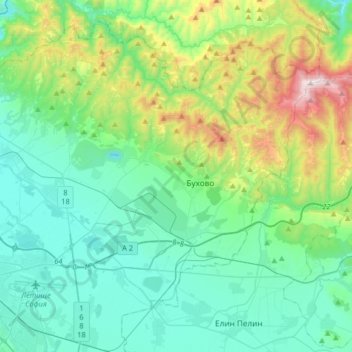
Name: Kremikovci topographic map, elevation, terrain.
Location: Kremikovci, Sofia City, Sofia-City, Bulgaria (42.67444 23.35298 42.86442 23.68030)
Average elevation: 737 m
Minimum elevation: 472 m
Maximum elevation: 1,681 m
Thank you for supporting this site ❤️
Make a donation
Make a donation
Gear up for your next adventure:
As an Amazon Associate, this site earns from qualifying purchases at no extra cost to you.