
Prut topographic map
Interactive map
Click on the map to display elevation.
About this map
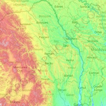
Name: Prut topographic map, elevation, terrain.
Location: Prut, Botoșani, Romania (45.46886 26.40717 48.26586 28.26144)
Average elevation: 401 m
Minimum elevation: -1 m
Maximum elevation: 2,353 m
Other topographic maps
Click on a map to view its topography, its elevation and its terrain.
Dorolea
Dorolea, Livezile, Bistrița-Năsăud, 427122, Romania
Average elevation: 488 m
Dealul cu Drum
Dealul cu Drum, Greci, Tulcea, 827080, Romania
Average elevation: 168 m