
Thank you for supporting this site ❤️
Make a donation
Make a donation
Gear up for your next adventure:
As an Amazon Associate, this site earns from qualifying purchases at no extra cost to you.
Moorang topographic map
Click on the map to display elevation.
Thank you for supporting this site ❤️
Make a donation
Make a donation
Gear up for your next adventure:
As an Amazon Associate, this site earns from qualifying purchases at no extra cost to you.
About this map
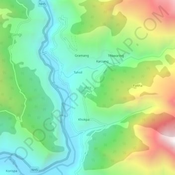
Name: Moorang topographic map, elevation, terrain.
Location: Moorang, Morang, Kinnaur, Himachal Pradesh, 172109, India (31.57805 78.42788 31.61805 78.46788)
Average elevation: 2,755 m
Minimum elevation: 2,224 m
Maximum elevation: 3,834 m
Thank you for supporting this site ❤️
Make a donation
Make a donation
Gear up for your next adventure:
As an Amazon Associate, this site earns from qualifying purchases at no extra cost to you.