
Morang topographic map
Interactive map
Click on the map to display elevation.
About this map
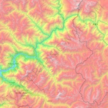
Name: Morang topographic map, elevation, terrain.
Location: Morang, Kinnaur, Himachal Pradesh, India (31.33293 78.06543 31.86754 78.84664)
Average elevation: 4,461 m
Minimum elevation: 1,952 m
Maximum elevation: 6,731 m
Other topographic maps
Click on a map to view its topography, its elevation and its terrain.
Shango
India > Himachal Pradesh > Kinnaur > Shango
Shango, Nichar, Kinnaur, Himachal Pradesh, 172118, India
Average elevation: 2,767 m